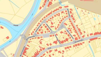
• Metadata Vlaanderen
  •  
  •  
  •  

GRBgis

Het Grootschalig Referentiebestand (GRB) of Basiskaart Vlaanderen is een geografisch informatiesysteem dat dient als topografische referentie voor Vlaanderen. Het is een gemeenschappelijke geografische basis waarop alle gebruikers eigen gegevens kunnen enten. Het GRB bevat enkel geografische en kenmerkende informatie van goed definieerbare, conventioneel aanvaarde referentiegegevens: gebouwen, percelen, wegen en hun inrichting, waterlopen, spoorbanen en het wegennetwerk. Deze objecten worden gedetailleerd en nauwkeurig opgemeten zodat de gegevens bruikbaar zijn in een grootschalige voorstelling met een schaalbereik tussen 1/250 en 1/5000.

owner : {{md.getOwnername()}}

{{'mdStatusRecord' | translate}}: {{('mdStatus-' + md.mdStatus) | translate}}
  • Identificatie
  • Inhoud
  • Referentiesysteem
  • Kwaliteit
  • Conformiteit
  • Toegangs- en gebruiksbeperkingen
  • Distributie
  • Meta-metadata
  • Objectencatalogus
  • Schema info
  • Ruimtelijke informatie

    Identificatie

    Identificatie


    Inhoud

    Inhoud

    Classification of data and services
     
    mdConstraintsSection
    gmd:resourceConstraints
     
     
    Metadata language Nederlands Dutch
    Character set UTF-8 UTF8: 8-bit variable size UCS Transfer Format, based on ISO/IEC 10646
     

Referentiesysteem

Reference system

Reference system identifier Belge 1972 / Belgian Lambert 72

Reference system

Reference system identifier Ostend height

Kwaliteit

gmd:dataQualityInfo
gmd:lineage
gmd:processStep
 
gmd:source
Collection method
 
gmd:processor
Metadata

Reference system

File identifier 7C823055-7BBF-4D62-B55E-F85C30D53162 XML
Metadata language Nederlands Dutch
Character set UTF-8 UTF8: 8-bit variable size UCS Transfer Format, based on ISO/IEC 10646
Hierarchy level Dataset: Information applies to the dataset
Hierarchy level name Dataset
Point of contact: Party who can be contacted for acquiring knowledge about or acquisition of the resource
agentschap Informatie Vlaanderen - Helpdesk Informatie Vlaanderen
Havenlaan 88 Brussel 1000 België

+32 9 276 15 00
https://overheid.vlaanderen.be/informatie-vlaanderen
Website https://overheid.vlaanderen.be/informatie-vlaanderen
Date stamp 2021-04-18
Metadata standard name ISO 19115/2003/Cor.1:2006/INSPIRE-TG2.0
Metadata standard version GDI-Vlaanderen Best Practices - versie 2.0
Reference system identifier Belge 1972 / Belgian Lambert 72

Reference system

Reference system identifier Ostend height

Data identification

Date (Revision: Date identifies when the resource was examined or re-examined and improved or amended) 2021-04-18
Date (Publication: Date identifies when the resource was issued) 2021-04-18
Edition Toestand 2021-04-18
Identifier E2707D13-B366-4D25-A286-E1B1330CADF7
Purpose Langetermijnoplossing voor de steeds toenemende vraag naar grootschalig referentiemateriaal voor Vlaanderen.
Status On going: Data is continually being updated
Custodian: Party that accepts accountability and responsability for the data and ensures appropriate care and maintenance of the resource
agentschap Informatie Vlaanderen - Helpdesk Informatie Vlaanderen
Havenlaan 88 Brussel 1000 België

+32 9 276 15 00
https://overheid.vlaanderen.be/informatie-vlaanderen
Website https://overheid.vlaanderen.be/informatie-vlaanderen
Owner: Party that owns the resource
agentschap Informatie Vlaanderen - Helpdesk Informatie Vlaanderen
Havenlaan 88 Brussel 1000 België

+32 9 276 15 00
https://overheid.vlaanderen.be/informatie-vlaanderen
Website https://overheid.vlaanderen.be/informatie-vlaanderen
Originator: Party who created the resource
agentschap Informatie Vlaanderen - Helpdesk Informatie Vlaanderen
Havenlaan 88 Brussel 1000 België

+32 9 276 15 00
https://overheid.vlaanderen.be/informatie-vlaanderen
Website https://overheid.vlaanderen.be/informatie-vlaanderen
INSPIRE - Spatial scope (Theme: Keyword identifies a particular subject or topic)
  • Regionaal
GEMET - Concepten, versie 2.4 (Theme: Keyword identifies a particular subject or topic)
  • geografie
  • (ge)bouwonderdeel
Keywords
  • aanhorigheid
  • administratief perceel
  • administratieve grens
  • adp
  • adres
  • afdak
  • afrit
  • ano
  • windturbine
  • anomalie
  • as built
  • as-builtplan
  • autosnelweg
  • baangracht
  • basiskaart
  • beek
  • bergplaats
  • berm
  • bijgebouw
  • bijhoudingszone
  • boordsteen
  • bouwsel
  • brandkraan
  • brug
  • bushok
  • cabine
  • capakey
  • chemische installatie
  • circulatiezone zwakke weggebruiker
  • constructie
  • CRAB
  • deelgemeente
  • deksel
  • dienstweg
  • drempel
  • elektriciteitspaal
  • fietsstalling
  • fietsweg
  • flitspaal
  • fontein
  • fout
  • garagetoegang
  • gba
  • gbg
  • gebouw
  • gebouw aan de grond
  • gebouwaanhorigheid
  • gemeente
  • gemeentegrens
  • gevel
  • gevellijn
  • gevelpunt
  • golfbreker
  • gracht
  • GRB
  • GRB gis
  • GRB-databank
  • GRB-gis
  • grenspaal
  • grootschalig
  • Grootschalig Referentiebestand
  • gvl
  • gvp
  • havendam
  • hoofdgebouw
  • hoogspanningsmast
  • huisnummer
  • ingezonken garagetoegang
  • kaart
  • kadastraal
  • kantsteen
  • keermuur
  • knw
  • koeltoren
  • kopmuur
  • kruispunt
  • kunstwerk
  • lbz
  • lokale bijhoudingszone
  • longitudinale inrichting
  • loopbrug
  • luik
  • mast
  • meer
  • meerpaal
  • metro
  • monument
  • mutatie
  • muur
  • niscode
  • onderkeldering
  • onverhard
  • onverharde zone
  • onvolledigheid
  • oppervlaktewater
  • oprit
  • opslagtank
  • overbrugging
  • paal
  • parallelweg
  • perceel
  • pijler
  • praatpaal
  • puntvormige inrichting
  • putdeksel
  • rail
  • referentiebestand
  • rijbaan
  • rivier
  • rooster
  • rotonde
  • sbn
  • schoorsteen
  • silo
  • sloot
  • spoor
  • spoorbaan
  • stad
  • staketsel
  • standbeeld
  • stootband
  • straatnaam
  • strandhoofd
  • telefooncabine
  • terrein
  • terreinobject
  • toponiem
  • tram
  • tramweg
  • trap
  • trein
  • trn
  • tunnelmond
  • TV-mast
  • uitbreiding
  • vangrail
  • ventweg
  • verdieping
  • verharding
  • verheven garagetoegang
  • verhoging
  • verkeersdrempel
  • verkeerslicht
  • verkeersplateau
  • verkeersplein
  • verlichtingspaal
  • VHA
  • vijver
  • Vlaamse Hydrografische Atlas
  • voetpad
  • wandelweg
  • water
  • waterbouwkundige constructie
  • watergang
  • waterloop
  • wateroppervlak
  • watertoren
  • waterweg
  • wbn
  • wcz
  • weg
  • wegaanhorigheid
  • wegbaan
  • wegbaaninrichting
  • weginrichting
  • wegknoop
  • wegopdeling
  • wegsegment
  • wegverbinding
  • wga
  • wgo
  • wgr
  • wkn
  • wlas
  • wli
  • woz
  • wpi
  • wrb
  • wri
  • wrl
  • wti
  • wtz
  • wvb
  • zichtbare onderkeldering
GDI-Vlaanderen Trefwoorden (Theme: Keyword identifies a particular subject or topic)
  • Vlaamse Open data
  • Herbruikbaar
  • Toegevoegd GDI-Vl
  • Kosteloos
Specific usage Gebruik als referentiekaart door integratie in toepassingen van Vlaamse overheden, lokale besturen, nutsbedrijven en andere
User: Party who uses the resource
Vlaamse overheden, lokale besturen, nutsbedrijven, en andere
Beschikbaarheid GRB gegevens: https://overheid.vlaanderen.be/GRB-Stand-van-zaken Gent 9000 België

+32 9 276 15 00
onbekend
Website onbekend
Legal constraints
Use limitation Beperking(en) op de publieke toegang
Access constraints Other restrictions: Limitation not listed
Other constraints Geen beperkingen op de publieke toegang.
Legal constraints
Use limitation Toegangs- en (her)gebruiksvoorwaarden
Use constraints Other restrictions: Limitation not listed
Other constraints De gegevens zijn beschermd door het auteursrecht. Indien u een ander type van gebruik wil maken van de gegevens, dan de hier vermelde, dient u zich te wenden tot de eigenaar van de gegevens.
Other constraints In uitvoering van het Vlaamse decreet voor hergebruik van overheidsinformatie, is het hergebruik geregeld d.m.v. de Modellicentie voor gratis hergebruik. Dit betekent dat elk commercieel of niet-commercieel hergebruik voor onbepaalde duur is toegelaten, zonder dat daar kosten aan verbonden zijn. Als enige gebruiksvoorwaarde geldt een bronvermeldingsplicht.
Other constraints Toegang en gebruik voor het uitvoeren van taken van algemeen belang, op niveau van Vlaamse overheidsinstanties is geregeld door het Besluit van de Vlaamse Regering met de regels voor toegang en gebruik van geografische gegevensbronnen toegevoegd aan de GDI, door deelnemers GDI-Vlaanderen. Dit gebruik is kosteloos.
Other constraints Toegang en gebruik voor het uitvoeren van taken van algemeen belang door niet-Vlaamse overheidsinstanties is geregeld door het Besluit van de Vlaamse Regering met de regels voor toegang en gebruik van geografische gegevensbronnen toegevoegd aan de GDI, door overheidsdiensten die geen deelnemer zijn aan GDI-Vlaanderen. Dit gebruik is kosteloos.
Other constraints Bronvermeldingsvoorschrift: “Bron: Grootschalig Referentie Bestand Vlaanderen, AIV”.
Other constraints Kosteloos gebruik van GRB door Netbeheerders van fysieke leidingnetten.
Alternate title CRAB databank
Date (Creation: Date identifies when the resource was brought into existence) 2002-08-13
Edition 1
Identifier 91D2F21C-A269-447A-BFC1-262F9AAE801A
Aggregate Datasetindentifier 0894E08F-A78F-4360-BB00-BEE3DCE1E94E
Association Type Cross reference: Reference from one dataset to another
Date
Identifier 0E4CDFD5-43C0-4F90-8245-EA16B6D699A9
Aggregate Datasetindentifier C944D3CD-1946-424C-8A64-FF0AFB994930
Association Type Cross reference: Reference from one dataset to another
Date
Identifier d313d736-e432-483f-a9b9-b4807f64d0a1
Aggregate Datasetindentifier 54877caf-3024-42b6-ad98-91d8434b9cda
Association Type Cross reference: Reference from one dataset to another
Date
Identifier 020a452d-8cd2-41b7-9c64-2be367668837
Aggregate Datasetindentifier c84f1f6e-ae07-4cad-988b-d245162a7e9c
Association Type Cross reference: Reference from one dataset to another
Spatial representation type Vector: Vector data is used to represent geographic data
Denominator 250
Metadata language Nederlands Dutch
Character set Latin-1 Latin-1: ISO/IEC 8859-1, Information technology - 8-bit single byte coded graphic character sets - Part 1 : Latin alphabet No.1
Topic category
  • Imagery base maps earth cover
Description Huidige begrenzing
N
S
E
W
thumbnail


Geographic identifier Beschikbaarheid GRB gegevens: https://overheid.vlaanderen.be/GRB-Stand-van-zaken
Begin date 2003-02-21
End date 2021-04-18
Supplemental Information Het GRB-objectenhandboek is te vinden op de website van Informatie Vlaanderen: https://overheid.vlaanderen.be/help/grb/objectcatalogus

Feature catalogue description

Included with dataset Yes
Feature catalogue citation
  • GRB

Distribution

Distribution format
  • Shapefile (nvt)

  • GML (2.1.2)

Distributor
Distributor: Party who distributes the resource
agentschap Informatie Vlaanderen - Helpdesk Informatie Vlaanderen
Havenlaan 88 Brussel 1000 België

+32 9 276 15 00
https://overheid.vlaanderen.be/informatie-vlaanderen
Website https://overheid.vlaanderen.be/informatie-vlaanderen
Fees Gratis
Ordering instructions Downloaden via Geopunt (http://www.geopunt.be/catalogus) of via de downloadtoepassing (http://download.vlaanderen.be)
Turnaround Maximaal 10 werkdagen
Units of distribution Vlaams Gewest
OnLine resource WMS GRB-basiskaart ( OGC:WMS-1.3.0-http-get-capabilities )

Via de WMS GRB-basiskaart kan je het Grootschalig Referentiebestand (GRB) opvragen en visualiseren als een kaart. De WMS GRB-basiskaart omvat alle GRB basiskaart gegevens gebaseerd op het GRBgis product. Voor een gedetailleerde databeschrijving van het GRB raadpleegt u best het GRB-objectenhandboek via https://overheid.vlaanderen.be/help/grb/objectcatalogus.

OnLine resource GRB_BSK ( OGC:WMS-1.3.0-http-get-map )

GRB-basiskaart

OnLine resource WMS GRB ( OGC:WMS-1.3.0-http-get-capabilities )

Via de WMS GRB kan je het Grootschalig Referentiebestand (GRB) opvragen en visualiseren als een kaart. De WMS GRB omvat alle GRB-gegevens gebaseerd op het GRBgis product. De gebruiker kan selecteren welke GRB-gegevens gevisualiseerd moeten worden en in welke volgorde. Voor een gedetailleerde databeschrijving van het GRB raadpleegt u best het GRB-objectenhandboek via https://overheid.vlaanderen.be/help/grb/objectcatalogus.

OnLine resource GRB_ADP ( OGC:WMS-1.3.0-http-get-map )

GRB - ADP - administratief perceel

OnLine resource GRB_ADP_GRENS ( OGC:WMS-1.3.0-http-get-map )

GRB - ADP - administratief perceel grens

OnLine resource GRB_SBN ( OGC:WMS-1.3.0-http-get-map )

GRB - SBN - spoorbaan

OnLine resource GRB_TRN ( OGC:WMS-1.3.0-http-get-map )

GRB - TRN - terrein

OnLine resource GRB_WBN ( OGC:WMS-1.3.0-http-get-map )

GRB - WBN - wegbaan

OnLine resource GRB_WTZ ( OGC:WMS-1.3.0-http-get-map )

GRB - WTZ - watergang

OnLine resource GRB_WLAS ( OGC:WMS-1.3.0-http-get-map )

GRB - WLAS - VHA-waterloopsegment

OnLine resource GRB_KNW ( OGC:WMS-1.3.0-http-get-map )

GRB - KNW - kunstwerk

OnLine resource GRB_GBG ( OGC:WMS-1.3.0-http-get-map )

GRB - GBG - gebouw aan de grondGRB - GBG - gebouw aan de grond

OnLine resource GRB_GBA ( OGC:WMS-1.3.0-http-get-map )

GRB - GBA - gebouwaanhorigheid

OnLine resource GRB_WGA ( OGC:WMS-1.3.0-http-get-map )

GRB - WGA - wegaanhorigheid

OnLine resource GRB_WVB ( OGC:WMS-1.3.0-http-get-map )

GRB - WVB - wegverbinding

OnLine resource GRB_WGR ( OGC:WMS-1.3.0-http-get-map )

GRB - WGR - gracht

OnLine resource GRB_WGO ( OGC:WMS-1.3.0-http-get-map )

GRB - WGO - wegopdeling

OnLine resource GRB_WLI ( OGC:WMS-1.3.0-http-get-map )

RB - WLI - longitudinale weginrichting

OnLine resource GRB_WTI ( OGC:WMS-1.3.0-http-get-map )

GRB - WTI - transversale weginrichting

OnLine resource GRB_WRL ( OGC:WMS-1.3.0-http-get-map )

GRB - WRL - spoorrail

OnLine resource GRB_WRI ( OGC:WMS-1.3.0-http-get-map )

GRB - WRI - putdeksel

OnLine resource GRB_WPI ( OGC:WMS-1.3.0-http-get-map )

GRB - WPI - puntvormige inrichting

OnLine resource GRB_WKN ( OGC:WMS-1.3.0-http-get-map )

GRB - WKN - wegknoop

OnLine resource GRB_ADT ( OGC:WMS-1.3.0-http-get-map )

GRB - ADT - verkorte kadastrale perceelsidentificatie

OnLine resource GRB_HNR_ADP ( OGC:WMS-1.3.0-http-get-map )

GRB - HNR_ADP - huisnummerlabel administratief perceel

OnLine resource GRB_HNR_KNW ( OGC:WMS-1.3.0-http-get-map )

GRB - HNR_KNW - huisnummerlabel kunstwerk

OnLine resource GRB_HNR_GBG ( OGC:WMS-1.3.0-http-get-map )

GRB - HNR_GBG - huisnummerlabel gebouw aan de grond

OnLine resource GRB_WNM ( OGC:WMS-1.3.0-http-get-map )

GRB - WNM - naam watergang

OnLine resource GRB_SNM_RECHTS ( OGC:WMS-1.3.0-http-get-map )

GRB - SNM - straatnaam rechts

OnLine resource GRB_SNM_LINKS ( OGC:WMS-1.3.0-http-get-map )

GRB - SNM - straatnaam links

OnLine resource GRB_SNM ( OGC:WMS-1.3.0-http-get-map )

GRB - SNM - straatnaam

OnLine resource GRB_GVL ( OGC:WMS-1.3.0-http-get-map )

GRB - GVL - gevellijn

OnLine resource GRB_GVP ( OGC:WMS-1.3.0-http-get-map )

GRB - GVP - gevelpunt

OnLine resource GRB_ANO ( OGC:WMS-1.3.0-http-get-map )

GRB - ANO - anomalie

OnLine resource GRB_LBZ1 ( OGC:WMS-1.3.0-http-get-map )

GRB - LBZ - Lokale bijhoudingszone - as-builtplan

OnLine resource GRB_LBZ2 ( OGC:WMS-1.3.0-http-get-map )

GRB - LBZ - Lokale bijhoudingszone - lokale bijhouding terrein

OnLine resource GRB_LBZ3 ( OGC:WMS-1.3.0-http-get-map )

GRB - LBZ - Lokale bijhoudingszone - lokale bijhouding adp

OnLine resource WMS GRB-basiskaart grijs ( OGC:WMS-1.3.0-http-get-capabilities )

Via de WMS GRB-basiskaart - grijswaarden kan je het Grootschalig Referentiebestand (GRB) opvragen en visualiseren als een kaart. De WMS GRB-basiskaart - grijswaarden omvat alle GRB basiskaart gegevens gebaseerd op het GRBgis product. Voor een gedetailleerde databeschrijving van het GRB raadpleegt u best het GRB-objectenhandboek via https://overheid.vlaanderen.be/help/grb/objectcatalogus.

OnLine resource GRB_BSK_GRIJS ( OGC:WMS-1.3.0-http-get-map )

GRB-basiskaart-grijswaarden

OnLine resource WMS GRB-selectie ( OGC:WMS-1.3.0-http-get-capabilities )

Via de WMS GRB-selectie kan je het Grootschalig Referentiebestand (GRB) opvragen en visualiseren als een kaart. De WMS GRB-selectie omvat een selectie van de GRB basiskaart gegevens gebaseerd op het GRBgis product. Voor een gedetailleerde databeschrijving van het GRB raadpleegt u best het GRB-objectenhandboek via https://overheid.vlaanderen.be/help/grb/objectcatalogus.

OnLine resource GRB_SEL ( OGC:WMS-1.3.0-http-get-map )

GRB-selectie

OnLine resource grb_bsk ( OGC:WMTS-1.0.0-http-get-tile )

GRB-basiskaart

OnLine resource agentschap Informatie Vlaanderen WMTS service ( OGC:WMTS-1.0.0-http-get-capabilities )

Web Map Tile Service van het agentschap Informatie Vlaanderen die alle data, die ontsloten worden als WMTS-laag, groepeert.

OnLine resource grb_bsk_grijs ( OGC:WMTS-1.0.0-http-get-tile )

GRB-basiskaart grijs

OnLine resource grb_sel ( OGC:WMTS-1.0.0-http-get-tile )

GRB-basiskaart selectie

Units of distribution Vlaams Gewest
OnLine resource WFS GRB ( OGC:WFS-1.1.0-http-get-capabilities )

Via de WFS GRB kan je de vectordata van de verschillende objecten uit het Grootschalig Referentiebestand (GRB) opvragen. De WFS GRB bevat alle GRB-gegevens gebaseerd op het GRBgis product. De gebruiker kan selecteren welke GRB-gegevens opgevraagd worden. Voor een gedetailleerde databeschrijving van het GRB raadpleegt u best het GRB-objectenhandboek via https://overheid.vlaanderen.be/producten/grb/objectcatalogus/entiteiten.

OnLine resource GRB:ADP ( OGC:WFS-1.1.0-http-get-feature )

GRB - ADP - administratief perceel

OnLine resource GRB:ANO ( OGC:WFS-1.1.0-http-get-feature )

GRB - ANO - anomalie

OnLine resource GRB:GBA ( OGC:WFS-1.1.0-http-get-feature )

GRB - GBA - gebouwaanhorigheid

OnLine resource GRB:GBG ( OGC:WFS-1.1.0-http-get-feature )

GRB - GBG - gebouw aan de grond

OnLine resource GRB:GVL ( OGC:WFS-1.1.0-http-get-feature )

GRB - GVL - gevellijn

OnLine resource GRB:GVP ( OGC:WFS-1.1.0-http-get-feature )

GRB - GVP - gevelpunt

OnLine resource GRB:KNW ( OGC:WFS-1.1.0-http-get-feature )

GRB - KNW - kunstwerk

OnLine resource GRB:LBZ ( OGC:WFS-1.1.0-http-get-feature )

GRB - LBZ - lokale bijhoudingszone

OnLine resource GRB:SBN ( OGC:WFS-1.1.0-http-get-feature )

GRB - SBN - spoorbaan

OnLine resource GRB:TBLADPADR ( OGC:WFS-1.1.0-http-get-feature )

GRB - TBLADPADR - huisnummer van een administratief perceel

OnLine resource GRB:TBLGBGADR ( OGC:WFS-1.1.0-http-get-feature )

GRB - TBLGBGADR - huisnummer van een gebouw aan de grond

OnLine resource GRB:TBLKNWADR ( OGC:WFS-1.1.0-http-get-feature )

GRB - TBLKNWADR - huisnummer van een kunstwerk

OnLine resource GRB:TRN ( OGC:WFS-1.1.0-http-get-feature )

GRB - TRN - terrein

OnLine resource GRB:WBN ( OGC:WFS-1.1.0-http-get-feature )

GRB - WBN - wegbaan

OnLine resource GRB:WGA ( OGC:WFS-1.1.0-http-get-feature )

GRB - WGA - wegaanhorigheid

OnLine resource GRB:WGO ( OGC:WFS-1.1.0-http-get-feature )

GRB - WGO - wegopdeling

OnLine resource GRB:WGR ( OGC:WFS-1.1.0-http-get-feature )

GRB - WGR - gracht

OnLine resource GRB:WKN ( OGC:WFS-1.1.0-http-get-feature )

GRB - WKN - wegknoop

OnLine resource GRB:WLAS ( OGC:WFS-1.1.0-http-get-feature )

GRB - WLAS - VHA-waterloopsegment

OnLine resource GRB:WLI ( OGC:WFS-1.1.0-http-get-feature )

GRB - WLI - longitudinale weginrichting

OnLine resource GRB:WPI ( OGC:WFS-1.1.0-http-get-feature )

GRB - WPI - puntvormige inrichting

OnLine resource GRB:WRI ( OGC:WFS-1.1.0-http-get-feature )

GRB - WRI - putdeksel

OnLine resource GRB:WRL ( OGC:WFS-1.1.0-http-get-feature )

GRB - WRL - spoorrail

OnLine resource GRB:WTI ( OGC:WFS-1.1.0-http-get-feature )

GRB - WTI - transversale weginrichting

OnLine resource GRB:WTZ ( OGC:WFS-1.1.0-http-get-feature )

GRB - WTZ - watergang

OnLine resource GRB:WVB ( OGC:WFS-1.1.0-http-get-feature )

GRB - WVB - wegverbinding

Name Online: Direct computer linkage
Units of distribution Vlaams Gewest
OnLine resource GRBgis ( WWW:DOWNLOAD-1.0-http--download )

Via de downloadtoepassing kan een gebruiker de vectordata van de verschillende objecten uit het Grootschalig Referentiebestand (GRB), afzonderlijk of allemaal samen, opvragen en dit als shapefile of gml. De gebruiker kan gegevens opvragen voor een specifieke zone (gemeente, provincie, Vlaanderen, kaartblad of een zelfgetekende zone). De gebruiker kan kiezen om ofwel de meest recente versie van de gegevens op te vragen, ofwel een historische versie op te vragen of de verschillen tussen twee gekozen tijdstippen op te vragen.

Name Online: Direct computer linkage

Data quality

Hierarchy level Dataset: Information applies to the dataset
Conformance result
Title VERORDENING (EU) Nr. 1089/2010 VAN DE COMMISSIE van 23 november 2010 ter uitvoering van Richtlijn 2007/2/EG van het Europees Parlement en de Raad betreffende de interoperabiliteit van verzamelingen ruimtelijke gegevens en van diensten met betrekking tot ruimtelijke gegevens
Date (Publication: Date identifies when the resource was issued) 2010-12-08
Explanation Geharmoniseerd volgens INSPIRE verordening
Pass No
Thematic classification correctness
Measure description Op de verschillende GRB-objecten zijn verschillende kwaliteitscontroles uitgevoerd.
Quantitative result
Value zie gegevensspecificaties
Completeness omission
Measure description Op de verschillende GRB-objecten zijn verschillende kwaliteitscontroles uitgevoerd.
Date / Time 2007-07-16T12:00:00
Quantitative result
Value zie gegevensspecificaties
Absolute external positional accuracy
Measure description Op de verschillende GRB-objecten zijn verschillende kwaliteitscontroles uitgevoerd.
Date / Time 2007-07-16T12:00:00
Quantitative result
Value zie gegevensspecificaties
Statement Aanmaak en bijhouding van het GRB
Description Initiele inventarisatie en kartering via fotorestitutie, terrestrische opmetingen, gegevensconversie en de interpretatie van kadastrale percelen.
Processor: Party wha has processed the data in a manner such that the resource has been modified
agentschap Informatie Vlaanderen
Koningin Maria Hendrikaplein 70 Gent 9000 België

+32 9 276 15 00
+32 9 276 15 05  https://overheid.vlaanderen.be/informatie-vlaanderen
Website https://overheid.vlaanderen.be/informatie-vlaanderen
Description Continue bijhouding ter hoogte van fouten, onvolledigheden en ontbrekende terreinobjecten via fotorestitutie, terrestrische opmeting, gegevensconversie en afstemming van gebouwen op kadastrale informatie.
Processor: Party wha has processed the data in a manner such that the resource has been modified
agentschap Informatie Vlaanderen
Koningin Maria Hendrikaplein 70 Gent 9000 België

+32 9 276 15 00
+32 9 276 15 05  https://overheid.vlaanderen.be/informatie-vlaanderen
Website https://overheid.vlaanderen.be/informatie-vlaanderen
Description Nieuwe versie objectcatalogus GRB (5.0.0) n.a.v. het aanbieden van verschilbestanden en historische bestanden (06/07/2017)
Date / Time 2017-07-06T12:00:00
Processor: Party wha has processed the data in a manner such that the resource has been modified
agentschap Informatie Vlaanderen -
Koningin Maria Hendrikaplein 70 Gent 9000 België

+32 9 276 15 00
+32 9 276 15 05  https://overheid.vlaanderen.be/informatie-vlaanderen
Website https://overheid.vlaanderen.be/informatie-vlaanderen
Description Nieuwe versie objectcatalogus GRB (5.1.0) n.a.v. de aanmaak van het uniek percelenplan (03/07/2018)
Date / Time 2018-07-03T12:00:00
Processor: Party wha has processed the data in a manner such that the resource has been modified
agentschap Informatie Vlaanderen -
Koningin Maria Hendrikaplein 70 Gent 9000 België

+32 9 276 15 00
+32 9 276 15 05  https://overheid.vlaanderen.be/informatie-vlaanderen
Website https://overheid.vlaanderen.be/informatie-vlaanderen
Description Nieuwe versie objectcatalogus GRB (6.0.x) n.a.v. uitbreiding GRB met windturbines en alle spoorrails en nieuw datamodel GRB-anomalieën (30/01/2020)
Date / Time 2020-01-29T12:00:00
Processor: Party wha has processed the data in a manner such that the resource has been modified
agentschap Informatie Vlaanderen -
Havenlaan 88 Brussel 1000 België

+32 9 276 15 00
+32 9 276 15 05  https://overheid.vlaanderen.be/informatie-vlaanderen
Website https://overheid.vlaanderen.be/informatie-vlaanderen


Conformiteit

Conformity


Toegangs- en gebruiksbeperkingen

mdLegalAndSecurityConstraintsSection

gmd:resourceConstraints
gmd:MD_LegalConstraints
gmd:otherConstraints
Metadata

Reference system

File identifier 7C823055-7BBF-4D62-B55E-F85C30D53162 XML
Metadata language Nederlands Dutch
Character set UTF-8 UTF8: 8-bit variable size UCS Transfer Format, based on ISO/IEC 10646
Hierarchy level Dataset: Information applies to the dataset
Hierarchy level name Dataset
Point of contact: Party who can be contacted for acquiring knowledge about or acquisition of the resource
agentschap Informatie Vlaanderen - Helpdesk Informatie Vlaanderen
Havenlaan 88 Brussel 1000 België

+32 9 276 15 00
https://overheid.vlaanderen.be/informatie-vlaanderen
Website https://overheid.vlaanderen.be/informatie-vlaanderen
Date stamp 2021-04-18
Metadata standard name ISO 19115/2003/Cor.1:2006/INSPIRE-TG2.0
Metadata standard version GDI-Vlaanderen Best Practices - versie 2.0
Reference system identifier Belge 1972 / Belgian Lambert 72

Reference system

Reference system identifier Ostend height

Data identification

Date (Revision: Date identifies when the resource was examined or re-examined and improved or amended) 2021-04-18
Date (Publication: Date identifies when the resource was issued) 2021-04-18
Edition Toestand 2021-04-18
Identifier E2707D13-B366-4D25-A286-E1B1330CADF7
Purpose Langetermijnoplossing voor de steeds toenemende vraag naar grootschalig referentiemateriaal voor Vlaanderen.
Status On going: Data is continually being updated
Custodian: Party that accepts accountability and responsability for the data and ensures appropriate care and maintenance of the resource
agentschap Informatie Vlaanderen - Helpdesk Informatie Vlaanderen
Havenlaan 88 Brussel 1000 België

+32 9 276 15 00
https://overheid.vlaanderen.be/informatie-vlaanderen
Website https://overheid.vlaanderen.be/informatie-vlaanderen
Owner: Party that owns the resource
agentschap Informatie Vlaanderen - Helpdesk Informatie Vlaanderen
Havenlaan 88 Brussel 1000 België

+32 9 276 15 00
https://overheid.vlaanderen.be/informatie-vlaanderen
Website https://overheid.vlaanderen.be/informatie-vlaanderen
Originator: Party who created the resource
agentschap Informatie Vlaanderen - Helpdesk Informatie Vlaanderen
Havenlaan 88 Brussel 1000 België

+32 9 276 15 00
https://overheid.vlaanderen.be/informatie-vlaanderen
Website https://overheid.vlaanderen.be/informatie-vlaanderen
INSPIRE - Spatial scope (Theme: Keyword identifies a particular subject or topic)
  • Regionaal
GEMET - Concepten, versie 2.4 (Theme: Keyword identifies a particular subject or topic)
  • geografie
  • (ge)bouwonderdeel
Keywords
  • aanhorigheid
  • administratief perceel
  • administratieve grens
  • adp
  • adres
  • afdak
  • afrit
  • ano
  • windturbine
  • anomalie
  • as built
  • as-builtplan
  • autosnelweg
  • baangracht
  • basiskaart
  • beek
  • bergplaats
  • berm
  • bijgebouw
  • bijhoudingszone
  • boordsteen
  • bouwsel
  • brandkraan
  • brug
  • bushok
  • cabine
  • capakey
  • chemische installatie
  • circulatiezone zwakke weggebruiker
  • constructie
  • CRAB
  • deelgemeente
  • deksel
  • dienstweg
  • drempel
  • elektriciteitspaal
  • fietsstalling
  • fietsweg
  • flitspaal
  • fontein
  • fout
  • garagetoegang
  • gba
  • gbg
  • gebouw
  • gebouw aan de grond
  • gebouwaanhorigheid
  • gemeente
  • gemeentegrens
  • gevel
  • gevellijn
  • gevelpunt
  • golfbreker
  • gracht
  • GRB
  • GRB gis
  • GRB-databank
  • GRB-gis
  • grenspaal
  • grootschalig
  • Grootschalig Referentiebestand
  • gvl
  • gvp
  • havendam
  • hoofdgebouw
  • hoogspanningsmast
  • huisnummer
  • ingezonken garagetoegang
  • kaart
  • kadastraal
  • kantsteen
  • keermuur
  • knw
  • koeltoren
  • kopmuur
  • kruispunt
  • kunstwerk
  • lbz
  • lokale bijhoudingszone
  • longitudinale inrichting
  • loopbrug
  • luik
  • mast
  • meer
  • meerpaal
  • metro
  • monument
  • mutatie
  • muur
  • niscode
  • onderkeldering
  • onverhard
  • onverharde zone
  • onvolledigheid
  • oppervlaktewater
  • oprit
  • opslagtank
  • overbrugging
  • paal
  • parallelweg
  • perceel
  • pijler
  • praatpaal
  • puntvormige inrichting
  • putdeksel
  • rail
  • referentiebestand
  • rijbaan
  • rivier
  • rooster
  • rotonde
  • sbn
  • schoorsteen
  • silo
  • sloot
  • spoor
  • spoorbaan
  • stad
  • staketsel
  • standbeeld
  • stootband
  • straatnaam
  • strandhoofd
  • telefooncabine
  • terrein
  • terreinobject
  • toponiem
  • tram
  • tramweg
  • trap
  • trein
  • trn
  • tunnelmond
  • TV-mast
  • uitbreiding
  • vangrail
  • ventweg
  • verdieping
  • verharding
  • verheven garagetoegang
  • verhoging
  • verkeersdrempel
  • verkeerslicht
  • verkeersplateau
  • verkeersplein
  • verlichtingspaal
  • VHA
  • vijver
  • Vlaamse Hydrografische Atlas
  • voetpad
  • wandelweg
  • water
  • waterbouwkundige constructie
  • watergang
  • waterloop
  • wateroppervlak
  • watertoren
  • waterweg
  • wbn
  • wcz
  • weg
  • wegaanhorigheid
  • wegbaan
  • wegbaaninrichting
  • weginrichting
  • wegknoop
  • wegopdeling
  • wegsegment
  • wegverbinding
  • wga
  • wgo
  • wgr
  • wkn
  • wlas
  • wli
  • woz
  • wpi
  • wrb
  • wri
  • wrl
  • wti
  • wtz
  • wvb
  • zichtbare onderkeldering
GDI-Vlaanderen Trefwoorden (Theme: Keyword identifies a particular subject or topic)
  • Vlaamse Open data
  • Herbruikbaar
  • Toegevoegd GDI-Vl
  • Kosteloos
Specific usage Gebruik als referentiekaart door integratie in toepassingen van Vlaamse overheden, lokale besturen, nutsbedrijven en andere
User: Party who uses the resource
Vlaamse overheden, lokale besturen, nutsbedrijven, en andere
Beschikbaarheid GRB gegevens: https://overheid.vlaanderen.be/GRB-Stand-van-zaken Gent 9000 België

+32 9 276 15 00
onbekend
Website onbekend
Legal constraints
Use limitation Beperking(en) op de publieke toegang
Access constraints Other restrictions: Limitation not listed
Other constraints Geen beperkingen op de publieke toegang.
Legal constraints
Use limitation Toegangs- en (her)gebruiksvoorwaarden
Use constraints Other restrictions: Limitation not listed
Other constraints De gegevens zijn beschermd door het auteursrecht. Indien u een ander type van gebruik wil maken van de gegevens, dan de hier vermelde, dient u zich te wenden tot de eigenaar van de gegevens.
Other constraints In uitvoering van het Vlaamse decreet voor hergebruik van overheidsinformatie, is het hergebruik geregeld d.m.v. de Modellicentie voor gratis hergebruik. Dit betekent dat elk commercieel of niet-commercieel hergebruik voor onbepaalde duur is toegelaten, zonder dat daar kosten aan verbonden zijn. Als enige gebruiksvoorwaarde geldt een bronvermeldingsplicht.
Other constraints Toegang en gebruik voor het uitvoeren van taken van algemeen belang, op niveau van Vlaamse overheidsinstanties is geregeld door het Besluit van de Vlaamse Regering met de regels voor toegang en gebruik van geografische gegevensbronnen toegevoegd aan de GDI, door deelnemers GDI-Vlaanderen. Dit gebruik is kosteloos.
Other constraints Toegang en gebruik voor het uitvoeren van taken van algemeen belang door niet-Vlaamse overheidsinstanties is geregeld door het Besluit van de Vlaamse Regering met de regels voor toegang en gebruik van geografische gegevensbronnen toegevoegd aan de GDI, door overheidsdiensten die geen deelnemer zijn aan GDI-Vlaanderen. Dit gebruik is kosteloos.
Other constraints Bronvermeldingsvoorschrift: “Bron: Grootschalig Referentie Bestand Vlaanderen, AIV”.
Other constraints Kosteloos gebruik van GRB door Netbeheerders van fysieke leidingnetten.
Alternate title CRAB databank
Date (Creation: Date identifies when the resource was brought into existence) 2002-08-13
Edition 1
Identifier 91D2F21C-A269-447A-BFC1-262F9AAE801A
Aggregate Datasetindentifier 0894E08F-A78F-4360-BB00-BEE3DCE1E94E
Association Type Cross reference: Reference from one dataset to another
Date
Identifier 0E4CDFD5-43C0-4F90-8245-EA16B6D699A9
Aggregate Datasetindentifier C944D3CD-1946-424C-8A64-FF0AFB994930
Association Type Cross reference: Reference from one dataset to another
Date
Identifier d313d736-e432-483f-a9b9-b4807f64d0a1
Aggregate Datasetindentifier 54877caf-3024-42b6-ad98-91d8434b9cda
Association Type Cross reference: Reference from one dataset to another
Date
Identifier 020a452d-8cd2-41b7-9c64-2be367668837
Aggregate Datasetindentifier c84f1f6e-ae07-4cad-988b-d245162a7e9c
Association Type Cross reference: Reference from one dataset to another
Spatial representation type Vector: Vector data is used to represent geographic data
Denominator 250
Metadata language Nederlands Dutch
Character set Latin-1 Latin-1: ISO/IEC 8859-1, Information technology - 8-bit single byte coded graphic character sets - Part 1 : Latin alphabet No.1
Topic category
  • Imagery base maps earth cover
Description Huidige begrenzing
N
S
E
W
thumbnail


Geographic identifier Beschikbaarheid GRB gegevens: https://overheid.vlaanderen.be/GRB-Stand-van-zaken
Begin date 2003-02-21
End date 2021-04-18
Supplemental Information Het GRB-objectenhandboek is te vinden op de website van Informatie Vlaanderen: https://overheid.vlaanderen.be/help/grb/objectcatalogus

Feature catalogue description

Included with dataset Yes
Feature catalogue citation
  • GRB

Distribution

Distribution format
  • Shapefile (nvt)

  • GML (2.1.2)

Distributor
Distributor: Party who distributes the resource
agentschap Informatie Vlaanderen - Helpdesk Informatie Vlaanderen
Havenlaan 88 Brussel 1000 België

+32 9 276 15 00
https://overheid.vlaanderen.be/informatie-vlaanderen
Website https://overheid.vlaanderen.be/informatie-vlaanderen
Fees Gratis
Ordering instructions Downloaden via Geopunt (http://www.geopunt.be/catalogus) of via de downloadtoepassing (http://download.vlaanderen.be)
Turnaround Maximaal 10 werkdagen
Units of distribution Vlaams Gewest
OnLine resource WMS GRB-basiskaart ( OGC:WMS-1.3.0-http-get-capabilities )

Via de WMS GRB-basiskaart kan je het Grootschalig Referentiebestand (GRB) opvragen en visualiseren als een kaart. De WMS GRB-basiskaart omvat alle GRB basiskaart gegevens gebaseerd op het GRBgis product. Voor een gedetailleerde databeschrijving van het GRB raadpleegt u best het GRB-objectenhandboek via https://overheid.vlaanderen.be/help/grb/objectcatalogus.

OnLine resource GRB_BSK ( OGC:WMS-1.3.0-http-get-map )

GRB-basiskaart

OnLine resource WMS GRB ( OGC:WMS-1.3.0-http-get-capabilities )

Via de WMS GRB kan je het Grootschalig Referentiebestand (GRB) opvragen en visualiseren als een kaart. De WMS GRB omvat alle GRB-gegevens gebaseerd op het GRBgis product. De gebruiker kan selecteren welke GRB-gegevens gevisualiseerd moeten worden en in welke volgorde. Voor een gedetailleerde databeschrijving van het GRB raadpleegt u best het GRB-objectenhandboek via https://overheid.vlaanderen.be/help/grb/objectcatalogus.

OnLine resource GRB_ADP ( OGC:WMS-1.3.0-http-get-map )

GRB - ADP - administratief perceel

OnLine resource GRB_ADP_GRENS ( OGC:WMS-1.3.0-http-get-map )

GRB - ADP - administratief perceel grens

OnLine resource GRB_SBN ( OGC:WMS-1.3.0-http-get-map )

GRB - SBN - spoorbaan

OnLine resource GRB_TRN ( OGC:WMS-1.3.0-http-get-map )

GRB - TRN - terrein

OnLine resource GRB_WBN ( OGC:WMS-1.3.0-http-get-map )

GRB - WBN - wegbaan

OnLine resource GRB_WTZ ( OGC:WMS-1.3.0-http-get-map )

GRB - WTZ - watergang

OnLine resource GRB_WLAS ( OGC:WMS-1.3.0-http-get-map )

GRB - WLAS - VHA-waterloopsegment

OnLine resource GRB_KNW ( OGC:WMS-1.3.0-http-get-map )

GRB - KNW - kunstwerk

OnLine resource GRB_GBG ( OGC:WMS-1.3.0-http-get-map )

GRB - GBG - gebouw aan de grondGRB - GBG - gebouw aan de grond

OnLine resource GRB_GBA ( OGC:WMS-1.3.0-http-get-map )

GRB - GBA - gebouwaanhorigheid

OnLine resource GRB_WGA ( OGC:WMS-1.3.0-http-get-map )

GRB - WGA - wegaanhorigheid

OnLine resource GRB_WVB ( OGC:WMS-1.3.0-http-get-map )

GRB - WVB - wegverbinding

OnLine resource GRB_WGR ( OGC:WMS-1.3.0-http-get-map )

GRB - WGR - gracht

OnLine resource GRB_WGO ( OGC:WMS-1.3.0-http-get-map )

GRB - WGO - wegopdeling

OnLine resource GRB_WLI ( OGC:WMS-1.3.0-http-get-map )

RB - WLI - longitudinale weginrichting

OnLine resource GRB_WTI ( OGC:WMS-1.3.0-http-get-map )

GRB - WTI - transversale weginrichting

OnLine resource GRB_WRL ( OGC:WMS-1.3.0-http-get-map )

GRB - WRL - spoorrail

OnLine resource GRB_WRI ( OGC:WMS-1.3.0-http-get-map )

GRB - WRI - putdeksel

OnLine resource GRB_WPI ( OGC:WMS-1.3.0-http-get-map )

GRB - WPI - puntvormige inrichting

OnLine resource GRB_WKN ( OGC:WMS-1.3.0-http-get-map )

GRB - WKN - wegknoop

OnLine resource GRB_ADT ( OGC:WMS-1.3.0-http-get-map )

GRB - ADT - verkorte kadastrale perceelsidentificatie

OnLine resource GRB_HNR_ADP ( OGC:WMS-1.3.0-http-get-map )

GRB - HNR_ADP - huisnummerlabel administratief perceel

OnLine resource GRB_HNR_KNW ( OGC:WMS-1.3.0-http-get-map )

GRB - HNR_KNW - huisnummerlabel kunstwerk

OnLine resource GRB_HNR_GBG ( OGC:WMS-1.3.0-http-get-map )

GRB - HNR_GBG - huisnummerlabel gebouw aan de grond

OnLine resource GRB_WNM ( OGC:WMS-1.3.0-http-get-map )

GRB - WNM - naam watergang

OnLine resource GRB_SNM_RECHTS ( OGC:WMS-1.3.0-http-get-map )

GRB - SNM - straatnaam rechts

OnLine resource GRB_SNM_LINKS ( OGC:WMS-1.3.0-http-get-map )

GRB - SNM - straatnaam links

OnLine resource GRB_SNM ( OGC:WMS-1.3.0-http-get-map )

GRB - SNM - straatnaam

OnLine resource GRB_GVL ( OGC:WMS-1.3.0-http-get-map )

GRB - GVL - gevellijn

OnLine resource GRB_GVP ( OGC:WMS-1.3.0-http-get-map )

GRB - GVP - gevelpunt

OnLine resource GRB_ANO ( OGC:WMS-1.3.0-http-get-map )

GRB - ANO - anomalie

OnLine resource GRB_LBZ1 ( OGC:WMS-1.3.0-http-get-map )

GRB - LBZ - Lokale bijhoudingszone - as-builtplan

OnLine resource GRB_LBZ2 ( OGC:WMS-1.3.0-http-get-map )

GRB - LBZ - Lokale bijhoudingszone - lokale bijhouding terrein

OnLine resource GRB_LBZ3 ( OGC:WMS-1.3.0-http-get-map )

GRB - LBZ - Lokale bijhoudingszone - lokale bijhouding adp

OnLine resource WMS GRB-basiskaart grijs ( OGC:WMS-1.3.0-http-get-capabilities )

Via de WMS GRB-basiskaart - grijswaarden kan je het Grootschalig Referentiebestand (GRB) opvragen en visualiseren als een kaart. De WMS GRB-basiskaart - grijswaarden omvat alle GRB basiskaart gegevens gebaseerd op het GRBgis product. Voor een gedetailleerde databeschrijving van het GRB raadpleegt u best het GRB-objectenhandboek via https://overheid.vlaanderen.be/help/grb/objectcatalogus.

OnLine resource GRB_BSK_GRIJS ( OGC:WMS-1.3.0-http-get-map )

GRB-basiskaart-grijswaarden

OnLine resource WMS GRB-selectie ( OGC:WMS-1.3.0-http-get-capabilities )

Via de WMS GRB-selectie kan je het Grootschalig Referentiebestand (GRB) opvragen en visualiseren als een kaart. De WMS GRB-selectie omvat een selectie van de GRB basiskaart gegevens gebaseerd op het GRBgis product. Voor een gedetailleerde databeschrijving van het GRB raadpleegt u best het GRB-objectenhandboek via https://overheid.vlaanderen.be/help/grb/objectcatalogus.

OnLine resource GRB_SEL ( OGC:WMS-1.3.0-http-get-map )

GRB-selectie

OnLine resource grb_bsk ( OGC:WMTS-1.0.0-http-get-tile )

GRB-basiskaart

OnLine resource agentschap Informatie Vlaanderen WMTS service ( OGC:WMTS-1.0.0-http-get-capabilities )

Web Map Tile Service van het agentschap Informatie Vlaanderen die alle data, die ontsloten worden als WMTS-laag, groepeert.

OnLine resource grb_bsk_grijs ( OGC:WMTS-1.0.0-http-get-tile )

GRB-basiskaart grijs

OnLine resource grb_sel ( OGC:WMTS-1.0.0-http-get-tile )

GRB-basiskaart selectie

Units of distribution Vlaams Gewest
OnLine resource WFS GRB ( OGC:WFS-1.1.0-http-get-capabilities )

Via de WFS GRB kan je de vectordata van de verschillende objecten uit het Grootschalig Referentiebestand (GRB) opvragen. De WFS GRB bevat alle GRB-gegevens gebaseerd op het GRBgis product. De gebruiker kan selecteren welke GRB-gegevens opgevraagd worden. Voor een gedetailleerde databeschrijving van het GRB raadpleegt u best het GRB-objectenhandboek via https://overheid.vlaanderen.be/producten/grb/objectcatalogus/entiteiten.

OnLine resource GRB:ADP ( OGC:WFS-1.1.0-http-get-feature )

GRB - ADP - administratief perceel

OnLine resource GRB:ANO ( OGC:WFS-1.1.0-http-get-feature )

GRB - ANO - anomalie

OnLine resource GRB:GBA ( OGC:WFS-1.1.0-http-get-feature )

GRB - GBA - gebouwaanhorigheid

OnLine resource GRB:GBG ( OGC:WFS-1.1.0-http-get-feature )

GRB - GBG - gebouw aan de grond

OnLine resource GRB:GVL ( OGC:WFS-1.1.0-http-get-feature )

GRB - GVL - gevellijn

OnLine resource GRB:GVP ( OGC:WFS-1.1.0-http-get-feature )

GRB - GVP - gevelpunt

OnLine resource GRB:KNW ( OGC:WFS-1.1.0-http-get-feature )

GRB - KNW - kunstwerk

OnLine resource GRB:LBZ ( OGC:WFS-1.1.0-http-get-feature )

GRB - LBZ - lokale bijhoudingszone

OnLine resource GRB:SBN ( OGC:WFS-1.1.0-http-get-feature )

GRB - SBN - spoorbaan

OnLine resource GRB:TBLADPADR ( OGC:WFS-1.1.0-http-get-feature )

GRB - TBLADPADR - huisnummer van een administratief perceel

OnLine resource GRB:TBLGBGADR ( OGC:WFS-1.1.0-http-get-feature )

GRB - TBLGBGADR - huisnummer van een gebouw aan de grond

OnLine resource GRB:TBLKNWADR ( OGC:WFS-1.1.0-http-get-feature )

GRB - TBLKNWADR - huisnummer van een kunstwerk

OnLine resource GRB:TRN ( OGC:WFS-1.1.0-http-get-feature )

GRB - TRN - terrein

OnLine resource GRB:WBN ( OGC:WFS-1.1.0-http-get-feature )

GRB - WBN - wegbaan

OnLine resource GRB:WGA ( OGC:WFS-1.1.0-http-get-feature )

GRB - WGA - wegaanhorigheid

OnLine resource GRB:WGO ( OGC:WFS-1.1.0-http-get-feature )

GRB - WGO - wegopdeling

OnLine resource GRB:WGR ( OGC:WFS-1.1.0-http-get-feature )

GRB - WGR - gracht

OnLine resource GRB:WKN ( OGC:WFS-1.1.0-http-get-feature )

GRB - WKN - wegknoop

OnLine resource GRB:WLAS ( OGC:WFS-1.1.0-http-get-feature )

GRB - WLAS - VHA-waterloopsegment

OnLine resource GRB:WLI ( OGC:WFS-1.1.0-http-get-feature )

GRB - WLI - longitudinale weginrichting

OnLine resource GRB:WPI ( OGC:WFS-1.1.0-http-get-feature )

GRB - WPI - puntvormige inrichting

OnLine resource GRB:WRI ( OGC:WFS-1.1.0-http-get-feature )

GRB - WRI - putdeksel

OnLine resource GRB:WRL ( OGC:WFS-1.1.0-http-get-feature )

GRB - WRL - spoorrail

OnLine resource GRB:WTI ( OGC:WFS-1.1.0-http-get-feature )

GRB - WTI - transversale weginrichting

OnLine resource GRB:WTZ ( OGC:WFS-1.1.0-http-get-feature )

GRB - WTZ - watergang

OnLine resource GRB:WVB ( OGC:WFS-1.1.0-http-get-feature )

GRB - WVB - wegverbinding

Name Online: Direct computer linkage
Units of distribution Vlaams Gewest
OnLine resource GRBgis ( WWW:DOWNLOAD-1.0-http--download )

Via de downloadtoepassing kan een gebruiker de vectordata van de verschillende objecten uit het Grootschalig Referentiebestand (GRB), afzonderlijk of allemaal samen, opvragen en dit als shapefile of gml. De gebruiker kan gegevens opvragen voor een specifieke zone (gemeente, provincie, Vlaanderen, kaartblad of een zelfgetekende zone). De gebruiker kan kiezen om ofwel de meest recente versie van de gegevens op te vragen, ofwel een historische versie op te vragen of de verschillen tussen twee gekozen tijdstippen op te vragen.

Name Online: Direct computer linkage

Data quality

Hierarchy level Dataset: Information applies to the dataset
Conformance result
Title VERORDENING (EU) Nr. 1089/2010 VAN DE COMMISSIE van 23 november 2010 ter uitvoering van Richtlijn 2007/2/EG van het Europees Parlement en de Raad betreffende de interoperabiliteit van verzamelingen ruimtelijke gegevens en van diensten met betrekking tot ruimtelijke gegevens
Date (Publication: Date identifies when the resource was issued) 2010-12-08
Explanation Geharmoniseerd volgens INSPIRE verordening
Pass No
Thematic classification correctness
Measure description Op de verschillende GRB-objecten zijn verschillende kwaliteitscontroles uitgevoerd.
Quantitative result
Value zie gegevensspecificaties
Completeness omission
Measure description Op de verschillende GRB-objecten zijn verschillende kwaliteitscontroles uitgevoerd.
Date / Time 2007-07-16T12:00:00
Quantitative result
Value zie gegevensspecificaties
Absolute external positional accuracy
Measure description Op de verschillende GRB-objecten zijn verschillende kwaliteitscontroles uitgevoerd.
Date / Time 2007-07-16T12:00:00
Quantitative result
Value zie gegevensspecificaties
Statement Aanmaak en bijhouding van het GRB
Description Initiele inventarisatie en kartering via fotorestitutie, terrestrische opmetingen, gegevensconversie en de interpretatie van kadastrale percelen.
Processor: Party wha has processed the data in a manner such that the resource has been modified
agentschap Informatie Vlaanderen
Koningin Maria Hendrikaplein 70 Gent 9000 België

+32 9 276 15 00
+32 9 276 15 05  https://overheid.vlaanderen.be/informatie-vlaanderen
Website https://overheid.vlaanderen.be/informatie-vlaanderen
Description Continue bijhouding ter hoogte van fouten, onvolledigheden en ontbrekende terreinobjecten via fotorestitutie, terrestrische opmeting, gegevensconversie en afstemming van gebouwen op kadastrale informatie.
Processor: Party wha has processed the data in a manner such that the resource has been modified
agentschap Informatie Vlaanderen
Koningin Maria Hendrikaplein 70 Gent 9000 België

+32 9 276 15 00
+32 9 276 15 05  https://overheid.vlaanderen.be/informatie-vlaanderen
Website https://overheid.vlaanderen.be/informatie-vlaanderen
Description Nieuwe versie objectcatalogus GRB (5.0.0) n.a.v. het aanbieden van verschilbestanden en historische bestanden (06/07/2017)
Date / Time 2017-07-06T12:00:00
Processor: Party wha has processed the data in a manner such that the resource has been modified
agentschap Informatie Vlaanderen -
Koningin Maria Hendrikaplein 70 Gent 9000 België

+32 9 276 15 00
+32 9 276 15 05  https://overheid.vlaanderen.be/informatie-vlaanderen
Website https://overheid.vlaanderen.be/informatie-vlaanderen
Description Nieuwe versie objectcatalogus GRB (5.1.0) n.a.v. de aanmaak van het uniek percelenplan (03/07/2018)
Date / Time 2018-07-03T12:00:00
Processor: Party wha has processed the data in a manner such that the resource has been modified
agentschap Informatie Vlaanderen -
Koningin Maria Hendrikaplein 70 Gent 9000 België

+32 9 276 15 00
+32 9 276 15 05  https://overheid.vlaanderen.be/informatie-vlaanderen
Website https://overheid.vlaanderen.be/informatie-vlaanderen
Description Nieuwe versie objectcatalogus GRB (6.0.x) n.a.v. uitbreiding GRB met windturbines en alle spoorrails en nieuw datamodel GRB-anomalieën (30/01/2020)
Date / Time 2020-01-29T12:00:00
Processor: Party wha has processed the data in a manner such that the resource has been modified
agentschap Informatie Vlaanderen -
Havenlaan 88 Brussel 1000 België

+32 9 276 15 00
+32 9 276 15 05  https://overheid.vlaanderen.be/informatie-vlaanderen
Website https://overheid.vlaanderen.be/informatie-vlaanderen


Distributie

gmd:distributionInfo

 
Distribution format
  • Shapefile (nvt)

  • GML (2.1.2)

Distributor
Distributor: Party who distributes the resource
agentschap Informatie Vlaanderen - Helpdesk Informatie Vlaanderen
Havenlaan 88 Brussel 1000 België

+32 9 276 15 00
https://overheid.vlaanderen.be/informatie-vlaanderen
Website https://overheid.vlaanderen.be/informatie-vlaanderen
Fees Gratis
Ordering instructions Downloaden via Geopunt (http://www.geopunt.be/catalogus) of via de downloadtoepassing (http://download.vlaanderen.be)
Turnaround Maximaal 10 werkdagen
Units of distribution Vlaams Gewest
OnLine resource WMS GRB-basiskaart ( OGC:WMS-1.3.0-http-get-capabilities )

Via de WMS GRB-basiskaart kan je het Grootschalig Referentiebestand (GRB) opvragen en visualiseren als een kaart. De WMS GRB-basiskaart omvat alle GRB basiskaart gegevens gebaseerd op het GRBgis product. Voor een gedetailleerde databeschrijving van het GRB raadpleegt u best het GRB-objectenhandboek via https://overheid.vlaanderen.be/help/grb/objectcatalogus.

OnLine resource GRB_BSK ( OGC:WMS-1.3.0-http-get-map )

GRB-basiskaart

OnLine resource WMS GRB ( OGC:WMS-1.3.0-http-get-capabilities )

Via de WMS GRB kan je het Grootschalig Referentiebestand (GRB) opvragen en visualiseren als een kaart. De WMS GRB omvat alle GRB-gegevens gebaseerd op het GRBgis product. De gebruiker kan selecteren welke GRB-gegevens gevisualiseerd moeten worden en in welke volgorde. Voor een gedetailleerde databeschrijving van het GRB raadpleegt u best het GRB-objectenhandboek via https://overheid.vlaanderen.be/help/grb/objectcatalogus.

OnLine resource GRB_ADP ( OGC:WMS-1.3.0-http-get-map )

GRB - ADP - administratief perceel

OnLine resource GRB_ADP_GRENS ( OGC:WMS-1.3.0-http-get-map )

GRB - ADP - administratief perceel grens

OnLine resource GRB_SBN ( OGC:WMS-1.3.0-http-get-map )

GRB - SBN - spoorbaan

OnLine resource GRB_TRN ( OGC:WMS-1.3.0-http-get-map )

GRB - TRN - terrein

OnLine resource GRB_WBN ( OGC:WMS-1.3.0-http-get-map )

GRB - WBN - wegbaan

OnLine resource GRB_WTZ ( OGC:WMS-1.3.0-http-get-map )

GRB - WTZ - watergang

OnLine resource GRB_WLAS ( OGC:WMS-1.3.0-http-get-map )

GRB - WLAS - VHA-waterloopsegment

OnLine resource GRB_KNW ( OGC:WMS-1.3.0-http-get-map )

GRB - KNW - kunstwerk

OnLine resource GRB_GBG ( OGC:WMS-1.3.0-http-get-map )

GRB - GBG - gebouw aan de grondGRB - GBG - gebouw aan de grond

OnLine resource GRB_GBA ( OGC:WMS-1.3.0-http-get-map )

GRB - GBA - gebouwaanhorigheid

OnLine resource GRB_WGA ( OGC:WMS-1.3.0-http-get-map )

GRB - WGA - wegaanhorigheid

OnLine resource GRB_WVB ( OGC:WMS-1.3.0-http-get-map )

GRB - WVB - wegverbinding

OnLine resource GRB_WGR ( OGC:WMS-1.3.0-http-get-map )

GRB - WGR - gracht

OnLine resource GRB_WGO ( OGC:WMS-1.3.0-http-get-map )

GRB - WGO - wegopdeling

OnLine resource GRB_WLI ( OGC:WMS-1.3.0-http-get-map )

RB - WLI - longitudinale weginrichting

OnLine resource GRB_WTI ( OGC:WMS-1.3.0-http-get-map )

GRB - WTI - transversale weginrichting

OnLine resource GRB_WRL ( OGC:WMS-1.3.0-http-get-map )

GRB - WRL - spoorrail

OnLine resource GRB_WRI ( OGC:WMS-1.3.0-http-get-map )

GRB - WRI - putdeksel

OnLine resource GRB_WPI ( OGC:WMS-1.3.0-http-get-map )

GRB - WPI - puntvormige inrichting

OnLine resource GRB_WKN ( OGC:WMS-1.3.0-http-get-map )

GRB - WKN - wegknoop

OnLine resource GRB_ADT ( OGC:WMS-1.3.0-http-get-map )

GRB - ADT - verkorte kadastrale perceelsidentificatie

OnLine resource GRB_HNR_ADP ( OGC:WMS-1.3.0-http-get-map )

GRB - HNR_ADP - huisnummerlabel administratief perceel

OnLine resource GRB_HNR_KNW ( OGC:WMS-1.3.0-http-get-map )

GRB - HNR_KNW - huisnummerlabel kunstwerk

OnLine resource GRB_HNR_GBG ( OGC:WMS-1.3.0-http-get-map )

GRB - HNR_GBG - huisnummerlabel gebouw aan de grond

OnLine resource GRB_WNM ( OGC:WMS-1.3.0-http-get-map )

GRB - WNM - naam watergang

OnLine resource GRB_SNM_RECHTS ( OGC:WMS-1.3.0-http-get-map )

GRB - SNM - straatnaam rechts

OnLine resource GRB_SNM_LINKS ( OGC:WMS-1.3.0-http-get-map )

GRB - SNM - straatnaam links

OnLine resource GRB_SNM ( OGC:WMS-1.3.0-http-get-map )

GRB - SNM - straatnaam

OnLine resource GRB_GVL ( OGC:WMS-1.3.0-http-get-map )

GRB - GVL - gevellijn

OnLine resource GRB_GVP ( OGC:WMS-1.3.0-http-get-map )

GRB - GVP - gevelpunt

OnLine resource GRB_ANO ( OGC:WMS-1.3.0-http-get-map )

GRB - ANO - anomalie

OnLine resource GRB_LBZ1 ( OGC:WMS-1.3.0-http-get-map )

GRB - LBZ - Lokale bijhoudingszone - as-builtplan

OnLine resource GRB_LBZ2 ( OGC:WMS-1.3.0-http-get-map )

GRB - LBZ - Lokale bijhoudingszone - lokale bijhouding terrein

OnLine resource GRB_LBZ3 ( OGC:WMS-1.3.0-http-get-map )

GRB - LBZ - Lokale bijhoudingszone - lokale bijhouding adp

OnLine resource WMS GRB-basiskaart grijs ( OGC:WMS-1.3.0-http-get-capabilities )

Via de WMS GRB-basiskaart - grijswaarden kan je het Grootschalig Referentiebestand (GRB) opvragen en visualiseren als een kaart. De WMS GRB-basiskaart - grijswaarden omvat alle GRB basiskaart gegevens gebaseerd op het GRBgis product. Voor een gedetailleerde databeschrijving van het GRB raadpleegt u best het GRB-objectenhandboek via https://overheid.vlaanderen.be/help/grb/objectcatalogus.

OnLine resource GRB_BSK_GRIJS ( OGC:WMS-1.3.0-http-get-map )

GRB-basiskaart-grijswaarden

OnLine resource WMS GRB-selectie ( OGC:WMS-1.3.0-http-get-capabilities )

Via de WMS GRB-selectie kan je het Grootschalig Referentiebestand (GRB) opvragen en visualiseren als een kaart. De WMS GRB-selectie omvat een selectie van de GRB basiskaart gegevens gebaseerd op het GRBgis product. Voor een gedetailleerde databeschrijving van het GRB raadpleegt u best het GRB-objectenhandboek via https://overheid.vlaanderen.be/help/grb/objectcatalogus.

OnLine resource GRB_SEL ( OGC:WMS-1.3.0-http-get-map )

GRB-selectie

OnLine resource grb_bsk ( OGC:WMTS-1.0.0-http-get-tile )

GRB-basiskaart

OnLine resource agentschap Informatie Vlaanderen WMTS service ( OGC:WMTS-1.0.0-http-get-capabilities )

Web Map Tile Service van het agentschap Informatie Vlaanderen die alle data, die ontsloten worden als WMTS-laag, groepeert.

OnLine resource grb_bsk_grijs ( OGC:WMTS-1.0.0-http-get-tile )

GRB-basiskaart grijs

OnLine resource grb_sel ( OGC:WMTS-1.0.0-http-get-tile )

GRB-basiskaart selectie

Units of distribution Vlaams Gewest
OnLine resource WFS GRB ( OGC:WFS-1.1.0-http-get-capabilities )

Via de WFS GRB kan je de vectordata van de verschillende objecten uit het Grootschalig Referentiebestand (GRB) opvragen. De WFS GRB bevat alle GRB-gegevens gebaseerd op het GRBgis product. De gebruiker kan selecteren welke GRB-gegevens opgevraagd worden. Voor een gedetailleerde databeschrijving van het GRB raadpleegt u best het GRB-objectenhandboek via https://overheid.vlaanderen.be/producten/grb/objectcatalogus/entiteiten.

OnLine resource GRB:ADP ( OGC:WFS-1.1.0-http-get-feature )

GRB - ADP - administratief perceel

OnLine resource GRB:ANO ( OGC:WFS-1.1.0-http-get-feature )

GRB - ANO - anomalie

OnLine resource GRB:GBA ( OGC:WFS-1.1.0-http-get-feature )

GRB - GBA - gebouwaanhorigheid

OnLine resource GRB:GBG ( OGC:WFS-1.1.0-http-get-feature )

GRB - GBG - gebouw aan de grond

OnLine resource GRB:GVL ( OGC:WFS-1.1.0-http-get-feature )

GRB - GVL - gevellijn

OnLine resource GRB:GVP ( OGC:WFS-1.1.0-http-get-feature )

GRB - GVP - gevelpunt

OnLine resource GRB:KNW ( OGC:WFS-1.1.0-http-get-feature )

GRB - KNW - kunstwerk

OnLine resource GRB:LBZ ( OGC:WFS-1.1.0-http-get-feature )

GRB - LBZ - lokale bijhoudingszone

OnLine resource GRB:SBN ( OGC:WFS-1.1.0-http-get-feature )

GRB - SBN - spoorbaan

OnLine resource GRB:TBLADPADR ( OGC:WFS-1.1.0-http-get-feature )

GRB - TBLADPADR - huisnummer van een administratief perceel

OnLine resource GRB:TBLGBGADR ( OGC:WFS-1.1.0-http-get-feature )

GRB - TBLGBGADR - huisnummer van een gebouw aan de grond

OnLine resource GRB:TBLKNWADR ( OGC:WFS-1.1.0-http-get-feature )

GRB - TBLKNWADR - huisnummer van een kunstwerk

OnLine resource GRB:TRN ( OGC:WFS-1.1.0-http-get-feature )

GRB - TRN - terrein

OnLine resource GRB:WBN ( OGC:WFS-1.1.0-http-get-feature )

GRB - WBN - wegbaan

OnLine resource GRB:WGA ( OGC:WFS-1.1.0-http-get-feature )

GRB - WGA - wegaanhorigheid

OnLine resource GRB:WGO ( OGC:WFS-1.1.0-http-get-feature )

GRB - WGO - wegopdeling

OnLine resource GRB:WGR ( OGC:WFS-1.1.0-http-get-feature )

GRB - WGR - gracht

OnLine resource GRB:WKN ( OGC:WFS-1.1.0-http-get-feature )

GRB - WKN - wegknoop

OnLine resource GRB:WLAS ( OGC:WFS-1.1.0-http-get-feature )

GRB - WLAS - VHA-waterloopsegment

OnLine resource GRB:WLI ( OGC:WFS-1.1.0-http-get-feature )

GRB - WLI - longitudinale weginrichting

OnLine resource GRB:WPI ( OGC:WFS-1.1.0-http-get-feature )

GRB - WPI - puntvormige inrichting

OnLine resource GRB:WRI ( OGC:WFS-1.1.0-http-get-feature )

GRB - WRI - putdeksel

OnLine resource GRB:WRL ( OGC:WFS-1.1.0-http-get-feature )

GRB - WRL - spoorrail

OnLine resource GRB:WTI ( OGC:WFS-1.1.0-http-get-feature )

GRB - WTI - transversale weginrichting

OnLine resource GRB:WTZ ( OGC:WFS-1.1.0-http-get-feature )

GRB - WTZ - watergang

OnLine resource GRB:WVB ( OGC:WFS-1.1.0-http-get-feature )

GRB - WVB - wegverbinding

Name Online: Direct computer linkage
Units of distribution Vlaams Gewest
OnLine resource GRBgis ( WWW:DOWNLOAD-1.0-http--download )

Via de downloadtoepassing kan een gebruiker de vectordata van de verschillende objecten uit het Grootschalig Referentiebestand (GRB), afzonderlijk of allemaal samen, opvragen en dit als shapefile of gml. De gebruiker kan gegevens opvragen voor een specifieke zone (gemeente, provincie, Vlaanderen, kaartblad of een zelfgetekende zone). De gebruiker kan kiezen om ofwel de meest recente versie van de gegevens op te vragen, ofwel een historische versie op te vragen of de verschillen tussen twee gekozen tijdstippen op te vragen.

Name Online: Direct computer linkage

Meta-metadata

gmd:MD_Metadata

 
File identifier 7C823055-7BBF-4D62-B55E-F85C30D53162 XML
Metadata language Nederlands Dutch
Character set UTF-8 UTF8: 8-bit variable size UCS Transfer Format, based on ISO/IEC 10646
Hierarchy level Dataset: Information applies to the dataset
Hierarchy level name Dataset
Date stamp 2021-04-18
Metadata standard name ISO 19115/2003/Cor.1:2006/INSPIRE-TG2.0
Metadata standard version GDI-Vlaanderen Best Practices - versie 2.0
Point of contact: Party who can be contacted for acquiring knowledge about or acquisition of the resource
agentschap Informatie Vlaanderen - Helpdesk Informatie Vlaanderen
Havenlaan 88 Brussel 1000 België

+32 9 276 15 00
https://overheid.vlaanderen.be/informatie-vlaanderen
Website https://overheid.vlaanderen.be/informatie-vlaanderen

Objectencatalogus

gmd:contentInfo

gmd:featureCatalogueCitation
featureCatalogueCitationUuidref
 
 
Citation proposal

Helpdesk Informatie Vlaanderen (agentschap Informatie Vlaanderen) (2021) . GRBgis. https://metadata.vlaanderen.be/srv/api/records/7C823055-7BBF-4D62-B55E-F85C30D53162

Overviews

overview
Voorbeeldweergave

Provided by

logo

Share on social sites

Associated resources


  •  
  •  
  •