 Metadata Vlaanderen
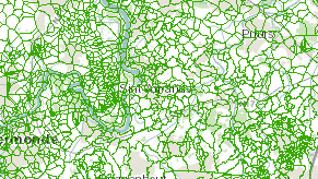
Afstroomgebieden Watertoets
Afstroomgebieden binnen Vlaanderen gebruikt om te bepalen wie de bevoegde adviesinstantie is bij de watertoets. De kaart is ruwweg gebaseerd op de natuurlijke afstroomgebieden, maar hierop zijn wijzigingen aangebracht voor bijvoorbeeld grensgebieden of Sigmagebieden. De kaart kan dan ook niet gebruikt worden als een exacte weergave van afstroomgebieden.
Simple
- Date (Creation date)
- 2020-10-29
- Date (Publication date)
- 2023-10-24
- Date (Revision date)
- 2024-02-01
- Date (Revision date)
- 2025-01-02
- Edition
-
Toestand 01/02/2024 - aangepast naar fusiegemeenten 2025
- Citation identifier
- dc55ccba-a27e-4d62-9e4e-d699ee73a16e
- Purpose
-
Ter bepaling van de adviesinstanties voor de watertoets.
- Status
- Completed
+32 2 553 21 05
https://www.vmm.be
+32 2 553 21 05
https://www.vmm.be
+32 2 553 21 05
https://www.vmm.be
- Keywords
-
-
AFSTROOMGEBIEDEN
-
VHA
-
VLAAMSE HYDROGRAFISCHE ATLAS
-
WATERTOETS
-
ADMINISTRATIEVE GRENZEN
-
AFGRENZINGEN AFSTROOMGEBIEDEN
-
WATERBEHEERDER
-
VHA-BESTANDEN
-
RAADPLEEGDIENST
-
WEB MAP SERVICE (WMS)
-
WMS
-
- Specific usage
-
Intern gebruik, watertoets.
+32 53 77 71 68
https://www.vmm.be
- Use limitation
-
De gegevens zijn auteursrechtelijk beschermd. Voor hergebruik (decreet Hergebruik van Overheidsinformatie) is Vlaamse Open Data licentie v1.0 van toepassing. De informatie is openbaar en eenieder heeft inzagerecht conform het decreet Openbaarheid van bestuur. Het gebruik voor taken van algemeen belang door instanties (openbare instellingen), is geregeld door het decreet betreffende de Geografische Data-infrastructuur Vlaanderen. Voor elk ander gebruik dient de gebruiker zich te wenden tot de eigenaar van de gegevens.Bronvermelding: “Bron: Vlaamse Milieumaatschappij”
- Access constraints
- Other restrictions
- Other constraints
-
zie Beperkingen
- Title
-
Vlaamse Hydrografische Atlas - Waterlopen, 29 oktober 2020
- Alternate title
-
VHA-waterlopen
- Date (Revision date)
- 2020-10-29
- Date (Publication date)
- 2020-10-29
- Edition
-
29 oktober 2020
- Citation identifier
- 0cfe7627-452f-44f9-b7e9-c4109924f839
- Aggregate Datasetindentifier
- 6a527ee2-360d-46a6-adc0-f41d02f5f0ce
- Association Type
- Cross reference
- Title
-
Vlaamse Hydrografische Atlas - Zones, 29 oktober 2020
- Alternate title
-
VHA-zones
- Date (Revision date)
- 2020-10-29
- Date (Publication date)
- 2020-10-29
- Edition
-
29 oktober 2020
- Citation identifier
- 14e08767-d254-473c-bf1a-03e8f2e9de47
- Aggregate Datasetindentifier
- c74e45c9-f51e-4639-89d3-ba49009fda1c
- Association Type
- Cross reference
- Spatial representation type
- Vector
- Denominator
- 10000
- Language
- Nederlands; Vlaams
- Character set
- 8859 Part 1
- Topic category
-
- Boundaries
- Inland waters
- Description
-
Huidige begrenzing
))
- Geographic identifier
- Vlaams Gewest
- Begin date
- 2020-10-29
- End date
- 2022-10-29
- Unique resource identifier
- WGS 84 / Pseudo-Mercator
- Distribution format
-
Name Version GML 2.1.2
+32 2 553 21 05
https://vmm.vlaanderen.be/
- Units of distribution
-
Vlaams Gewest
- OnLine resource
- https://www.waterinfo.be/watertoets
- Units of distribution
-
Vlaams Gewest
- OnLine resource
-
0
(
OGC:WMS
)
WMS Vlaamse Milieumaatschappij
- OnLine resource
-
0
(
OGC:WMS-1.3.0-http-get-capabilities
)
Afstroomgebieden
- OnLine resource
-
0
(
OGC:WMS-1.3.0-http-get-map
)
Watertoets - Afstroomgebieden
- Name
- Online
- Hierarchy level
- Dataset
- Statement
-
Aanmaak kaart afstroomgebieden watertoets
- Description
-
berekenen afstroomgebieden op basis van VHA en DHM
+32 2 553 21 05
http://www.waterinfo.be
- Description
-
Correctie voor grensgebieden, administratieve grenzen en SIGMA-gebieden
- Date / Time
- 2016-09-01T12:00:00
+32 2 553 21 05
http://www.waterinfo.be
Meta-metadata
- File identifier
- 9360c3f3-303d-40bb-8ba6-b86658501929 XML
- Metadata language
- Nederlands; Vlaams
- Character set
- UTF8
- Hierarchy level
- Dataset
- Hierarchy level name
-
Dataset
- Date stamp
- 2025-01-07
- Metadata standard name
-
ISO 19115/2003/Cor.1:2006/INSPIRE-TG2.0
- Metadata standard version
-
GDI-Vlaanderen Best Practices - versie 2.0
https://vmm.vlaanderen.be/
)))