 Metadata Vlaanderen
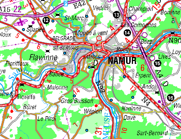
Topografische kaart 1/250.000, raster
Het rasterbestand van de topografische kaart 1:250.000 is grotendeels gebaseerd op Topografische vectordatabank 1:250.000 (top 250-v). De gegevens in verband met hydrografie, wegen, enz, zijn afgeleid van de vectordatabank. De bodemgegevens zijn afkomstig van satellietbeelden (Landsat). Ook zijn de toponymie van o.a. de gemeenten erin opgenomen. Zij bevat geen hoogtelijnen. Het bestand (België + Luxemburg) is beschikbaar in 380 dpi (15 dots per mm) of in 150 dpi (gegeneraliseerde versie).
Simple
- Alternate title
-
top250-r
- Date (Revision date)
- 1999-05-20
- Citation identifier
- 6BB4781D-D024-426E-B440-C41807C3D19A
- Purpose
-
Wettelijke opdracht NGI.
- Status
- Historical archive
+32 2 629 82 12
https://www.ngi.be
+32 2 629 82 12
https://www.ngi.be
+32 2 629 82 12
https://www.ngi.be
+32 2 629 82 12
https://www.ngi.be
- Keywords
-
-
NGI
-
WEGEN
-
TOPOKAART
-
HOOGTELIJNEN
-
HYDROGRAFIE
-
VECTORDATABANK
-
LUXEMBURG
-
TOPONYMIE
-
TOPOGRAFISCHE KAART
-
TOPOGRAFIE
-
- Specific usage
-
o.a. het commercialiserenvan het bestand.
+32 2 629 82 12
https://www.ngi.be
- Use limitation
-
Contact opnemen met NGI Eigendom en auteursrechten berusten bij het Nationaal Geografisch Instituut (NGI)
- Access constraints
- Copyright
- Use constraints
- License
- Title
-
Topografische databank 1:250.000
- Alternate title
-
databank van de grote structuren
- Alternate title
-
top 250-v
- Date (Revision date)
- 1999-05-19
- Citation identifier
- E2F019C4-B90B-4E62-9AA5-CB3FF2060442
- Aggregate Datasetindentifier
- A7804610-78F1-4327-A49E-864295391305
- Association Type
- Cross reference
- Spatial representation type
- Grid
- Denominator
- 250000
- Language
- Nederlands; Vlaams
- Language
- Français
- Character set
- 8859 Part 1
- Topic category
-
- Imagery base maps earth cover
- Description
-
Huidige begrenzing
))
- Geographic identifier
- geen informatie
- Begin date
- 1900-01-01
- End date
- 1900-01-01
- Unique resource identifier
- Belge 1972 / Belgian Lambert 72
- Unique resource identifier
- Ostend height
- Distribution format
-
Name Version TIFF Niet gekend
Distributor
+32 2 629 82 12
https://www.ngi.be
- Fees
-
1289.05 euro voor gans België (380 dpi) 297.47 euro voor gans België (150 dpi)
- Ordering instructions
-
Zie eigenaar/verdeler
- Units of distribution
-
België
- Hierarchy level
- Dataset
- Statement
-
Aanmaak topografische kaart, raster
- Description
-
Het genereren van een kleurenrasterbestand vanaf de Topografische vectordatabank (top250-v) voor de gegevens i.v.m. hydrografie, wegen, enz. . Het invoegen van bodemgegevens afkomstig satellietbeelden.
+32 2 629 82 12
http://www.ngi.be
- Included with dataset
- Yes
- Feature catalogue citation
Meta-metadata
- File identifier
- 50C3BF1A-FA7F-4E5A-8C6B-A968256FF8B7 XML
- Metadata language
- Nederlands; Vlaams
- Character set
- UTF8
- Hierarchy level
- Dataset
- Hierarchy level name
-
Dataset
- Date stamp
- 2024-07-03
- Metadata standard name
-
ISO 19115/2003/Cor.1:2006/INSPIRE-TG2.0
- Metadata standard version
-
GDI-Vlaanderen Best Practices - versie 2.0
)))